Posts

11-12-21, Frazier Mountain W6/CC-003

Image
 

11-6-21, Marys Peak W7O/CC-001

Image
  I was on a business trip to Oregon and decided to stay the weekend.  There was a summit about an hour away from the hotel.  It was the highest point in Oregon at a little over 4,000 feet, although small by California standards. This was a cold and windy day, and it was lightly snowing, so I didn't really take any photos.  I took the above photo off Google images, because you could not see the mountain through the clouds at all. This is a drive up except the last mile, which is an easy hike with about 350 feet of elevation gain to the summit proper.  I got to the parking lot about 7AM, but it was too dark and windy to start the hike.  I feel asleep in the car until about 8:30, then waited another half hour or so for the wind to die down a little.  I got out of the car to check out the use fee, which was $5, and all the payment envelopes were wet so the slot to put them in was blocked.  After I spent a couple of minutes trying to stuff the payment...

10-16-21, Lookout Mountain W6/ND-037

Image
I love my wife.  We decided (at the last minute) to take a weekend trip to Yosemite National Park.  And she was completely supportive of spending our first couple of hours Saturday morning on a nice drive up south of Mono lake in the Inyo National Forest.  We were staying in El Portal on the west side of the park, so we'd have to drive over an hour to get to the east entrance, and then another hour to get to the summit.  We decided to get there directly and then do site seeing along the way back. Google Maps pretty much takes you to the top of Lookout Mountain, although the last few miles are a dirt road, and as others have pointed out, there's lots of Obsidian in parts of the road that are a little nerve-wracking.  It really wasn't as bad as I expected.  It was only in two or three places up close to the summit, and the rest was pretty well ground into the road. The views were stunning, so after Michele helped me set up the end fed (she's got a much better...

10-10-2021, Coyote Peak W6/NC-399

Image
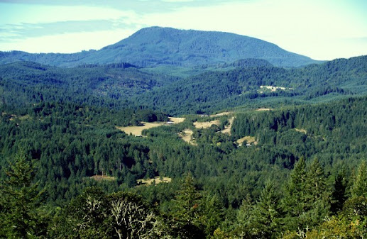
It has been quite some time since the last summit, nearly 3 months.  During the three summit run in Arkansas and Oklahoma, I started to cough.  By the time I arrived in Dallas, TX, I had contracted Covid-19, and was shut down for two and a half weeks with another six weeks or so of respiratory recovery.  The thought of being at altitude again was pretty scary for awhile. I felt up to doing something easy, so Peter and I discussed chasing summits at Mount Umanhum.  We activated that already this year, so it would be a strict chasing event.  By the time he arrived at my house for the ride up, he felt more like going to Coyote Peak again.  I was concerned about the hike, but decided to give it a try. After a lot of rest stops for me to catch my breath, we made it to the top.  The views were pretty nice, unlike the last time we were up top and it was really foggy.  There's a large space at the top with several benches.  We set up in the same plac...

7-27-21 Triple Header W5A/OH-001, W5O/OU-006 and W5O/OU-005

Image
We planned to drive through Choctaw territory out of Arkansas and into Oklahoma so we could wind up in Durant and see the newly opened Choctaw History museum.  I found three drive up summits along the same stretch of road that wasn't too far from our route, so I made plans to do them all in the same day. They have all been  activated a lot and there were some recent summit access notes so I felt fairly confident we could pull this off.  It was a long day, but we made it.  W5A/OH-001 Rich Mountain The first one we'd tackle was Rich Mountain.  If you put Rich Mountain in Google Maps, it doesn't take you to the summit, but it does take you to the town of Rich Mountain which is the best way to get there.  We stopped at a really old general store, almost a shack, where we think we met the entire town.  There were four men playing checkers in the back and a fifth bringing in something from the car.  Very friendly bunch.  Our main purpose was a bath...

7-24-21 W5A-BR-012 Whitney Mountain

Image
  After a really fun night watching the Presley's Country Jubilee, we left Branson MO and went back into Northern Arkansas, and my wife Michele (KM6GPZ) and I spent some time around Beaver Lake, a man-made lake formed by a dam on the White River in the beautiful Ozarks.  The huge lakes in this part of the country are narrow but they span for miles and miles.  Beaver Lake is over 22,000 acres in surface area. As we made the drive up to the summit of Whitney Mountain, we were both very hungry but couldn't find anything along the route.  I had read there was some sort of a lodge at the top so we were hoping there would be a restaurant too.  The drive up was fairly easy, but once we got to the top, I found the lodge was closed down and there was no stores or cafes, so we'd have to activate while hungry.  This provided me a bit of motivation to get set up quickly. In addition to the lodge, there was a (closed) community center and what looked like some residence...

7/20/21 W5N/SI-001 Sandia Crest

Image
  Me and my wife Michele (KM6GPZ) went on a 3 week road trip from California to Missouri and back, and I identified some drive  up summits to activate in various places along the way.  It was the middle of July and I knew it would be very hot, so I wanted to avoid hiking.  I also wanted to find peaks that would be relatively quick to activate so they didn't cut into our road trip too much. We spent the night in Albuquerque.  As we drove into town, we saw the massive Sandi Crest towering over the city.  I tried to take a couple of photos through the front car window but none of them really did it justice.  The crest itself is 10,678 ft, but the basic elevation of the city of Albuquerque is around 5100 feet, so compared to some of the summits back home, it wasn't really that high up.  But because the general area had very few other mountains, it was pretty stunning. The drive up was about 21 miles full of switchbacks on the back side of the peak....