3-27-21 Double Header W6/SC-155 and W6/NC-150
W6/SC-155 Mount Bielawski
We were a lot more ambitious today, and decided to hit at least two peaks in one day. Our plan A was to hope the Mountain Winery was opened up for business so we could park in the lot and tackle Table Mountain, but they're still closed. We'll have to save that for another day.
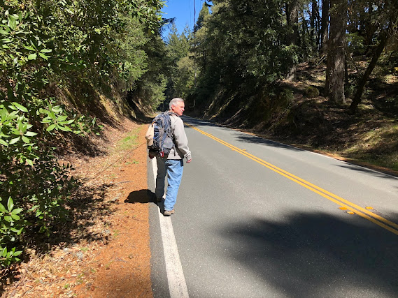
So plan B was to start with Mount Bielawski. This summit itself is on private property but the activation zone extends into areas within Castle Rock State Park. We did a little research and watched the video on the SOTA site beforehand. In fact, Peter and I drove by this peak in the rain when we did El Sereno a while back, so we already had an idea of what to expect. The road to the peak is private and gated, but you can park just up the road in the Castle Rock State Park lot and do a short easy jaunt down the highway to get to the trailhead. We passed the lot closest to the summit and ended up at the main lot, which was pretty packed. I decided to drive back up to the closer lot and someone pulled out just as I arrived, so we snagged the space. But it was really full so I got lucky to get this space.
People can fly around the blind curves so we tried to be careful what side of the road we were walking on to maximize the ground we had available to move out of the way if someone came slamming by. There isn't a lot of shoulder.
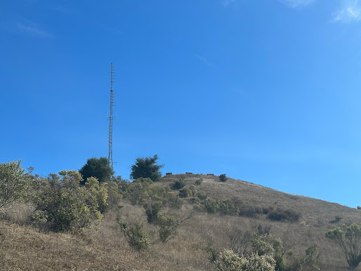
As you get closer to the summit, there is a trail head.
Others have said you can walk up this trail just a bit and be in the activation zone. I had GaiaGPS loaded on my iPhone, and I set up the overlays I had downloaded that shows private property boundaries. There was a boundary just above this to the left, and the summit was just a few hundred feet beyond that. Right at the gate there is a barb wire fence going up the hill to a little flat space that looked like a perfect place to operate. It was an old trail or road or something similar. According to my GPS app, it was just inside the private property boundary line. So we scurried up the steep hillside to that point and scouted it out.
Our friend Butch, K6WEF, was planning on trying to track us with APRS throughout the day, so we both had beaconing HT's with us and Butch was contacting us regularly on the local repeater with the results. I guess HT's don't work too well in the mountains because he didn't see us show up on the map very much.
Peter brought his new Packtenna multiband dipole and his new Sotabeams carbon 6 mast, and wanted to give it a try. He had the 40m extensions so we set up the whole thing. He bungee-corded the mast to a tree and we used the dipole as guys, borrowing some stakes from my kit to hold the ends. On the first attempt, the mast bent over so much the antenna fell off the top. It seemed a little heavy, so I had some thinner RG-174 with BNC ends to run up the pole, and we connected his RG-58 to that. A little longer run than we wanted, but it didn't have the weight so the mast stayed up.
If there was any loss in the coax it didn't matter much. 30m CW tuned up well, as did 40m phone. The KX2 can tune just about anything. We tried to chase a couple of summits and Peter bagged a 10 pointer. There was plenty of cell phone service but Peter spotted himself with APRS just to test, and it worked great. I moved over to 40m SSB and got several other summits as well. We made enough contacts pretty quickly for both of us to activate the peak, packed up, and took off for the next one. Peter's new dipole performed nicely.
SOTA Activation Info:
Parking close by, but very popular spot so it can be full
Decent ATT cell service but it is in and out
Easy Hike on a road so watch out for crazy mountain drivers
No fees unless you have to park in the main lot
Watch out for private property - cannot go to the actual peak without trespassing
Bathrooms at Castle Rock State Park
Lots of trees around to use for antennas
No RFI that we could detect
Good spot for 2m FM as well - can get into San Jose on simplex.
W5RJD's Log
| Time | Callsign | Band | Mode | Notes |
|---|---|---|---|---|
| 18:10 | W6WSS | 7MHz | SSB | W6/SD-010 |
| 18:10 | KB6AE | 7MHz | SSB | W6/SD-010 |
| 18:49 | NW7E | 7MHz | SSB | |
| 18:50 | K6KMA | 7MHz | SSB | |
| 18:51 | WY7N | 7MHz | SSB | W7U/TO-050 ? |
| 18:52 | NR7Y | 7MHz | SSB | W7O/NC-071 |
WB6POT's Log
| Time | Callsign | Band | Mode | Notes |
|---|---|---|---|---|
| 18:16 | KT5X | 7MHz | CW | 559/329 |
| 18:17 | K7SO | 7MHz | CW | 559/549 |
| 18:17 | W7GA | 7MHz | CW | 559/559 |
| 18:18 | W7RV | 7MHz | CW | 579/559 |
| 18:20 | KX0R | 7MHz | CW | 449/449 |
| 18:23 | WB7ULD | 7MHz | CW | 579/519 |
Black Mountain W6/NC-150
At this point it was about noon and we were ready for summit #2. We drove back highway 9 to 35 (Skyline Boulevard, a ridgeline road), and then took that to Page Mill Rd. A few miles down is the Montebello Parking area. There are two lots to choose from and both were fairly full. I pulled into the smaller one and a car started to back out. Scored again! That was two lucky spots in the same day!
I had loaded the most direct route into GaiaGPS and it said that there was about 285 feet of elevation gain. It lied. This was a constant uphill trip with only occasional shade.
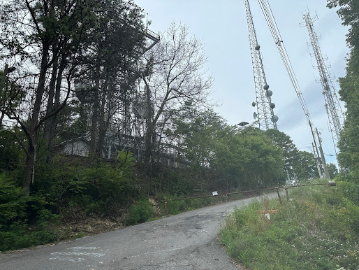
The trail was about 2.4 miles one way, or just under 5 miles round trip. There were a number of forks so we had to be careful to stay on the right trail. It was very hot but the views were stunning. Eventually we started to parallel Monte Bello Road, which is a drivable road but you have to be a ranger or have permission to drive to the radio towers. I watched as a ranger drove by in a truck - lucky them.
We lost contact on the repeater with Butch during the hike, but heard him long enough to let us know we weren't showing up on APRS. I don't know if it was the RFI from the towers or the lack of digipeaters in the area.
I learned to bring more water next time for a longer hike. As we got closer to the top I could feel myself starting to dehydrate a bit, but I only had one bottle with me and I was concerned about drinking it up too quickly. Peter went on ahead to scout out the activation zone. We stayed in touch on simplex as most of the repeaters were out of range, but even that was a little challenging.
Peter found a shaded area just inside the activation zone off the main road. We didn't go all the way to the towers or get anywhere near the actual peak this time. Many people have written that the interference up there was pretty heavy, so we decided to avoid it. This peak seems to have a huge activation zone, maybe because it's pretty flat at the top.
As soon as I got there we threw the end fed into a tree and started making contacts. I devoured my water, I just couldn't stand it anymore. I knew I'd regret that on the way back.
Peter started on CW again. We've got this new system where he will pick a band, usually 30m, spot himself, and work CW until nobody else is left, then I take over. After the experience on Santa Rosalia where I barely got my four contacts, we decided this was the best way to split the QSO's with only one radio. He was very excited when his CW instructor, W7EEE, came back to his CQ. I then worked 40m SSB just until the chasers stopped responding. We didn't stay very long, got just a little more than we needed to activate the summit, and then we took off.
Just a few hundred feet from where we activated there was a backpack camp. I thought to myself, if you could get permits for Dec 31 to stay overnight, you could also hit this peak on New Year's day and get two activations. Something to think about for next time. It would be some cold weather camping though.
All throughout the hike on the way up and back, there was this dude singing at the top of his lungs. It was a little creepy, like he was following us. He had an okay voice or it would have been really annoying. And another guy was behind us on the way up and overheard us talking about putting up antennas. We ran into him again on the way back and he was genuinely interested in getting his license, so we chatted with him about that for a bit.
Hiking down was easier but without water I felt myself getting more dehydrated as we hiked. This one was probably a little outside my current body capabilities but I made it back to the road, and sent Peter up several hundred yards to bring the truck back. As soon as I got into the car I drank all three of the bottles of water I had left.
Besides the water, the other lesson I learned on this trip to double check the elevation gain when you plot your route. I figured I must have done something incorrectly, so when I got home I plotted the same route and checked it again on GaiaGPS. This time it showed 815 ft of ascent and 222 ft of descent from the parking lot to the summit. If I had seen that earlier, I might have decided not to go on this one, but it was definitely worth the views and the exercise and I'm glad I made it. The main reason I'm doing SOTA activations is to get back to the point where a hike like this is no big deal. Peter and I are like the tortoise and the hare- he's very patient with me.
I noticed I was able to work WU7H again - he was my very first S2S contact last year. As I'm getting more into this it is clear that the same callsigns do tend to appear again and again.
SOTA Activation Info:
Parking about 2.5 mi from summit, but very popular spot so can be full
Decent ATT cell service
Moderate hike, limited shade
No fees
Bathrooms at parking lot and at backpack camp at the top
Trees are available within activation zone
Heavy RFI on 2M
Parking about 2.5 mi from summit, but very popular spot so can be full
Decent ATT cell service
Moderate hike, limited shade
No fees
Bathrooms at parking lot and at backpack camp at the top
Trees are available within activation zone
Heavy RFI on 2M
W5RJD's Log
| Time | Callsign | Band | Mode | Notes |
|---|---|---|---|---|
| 22:02 | K6KMH | 7MHz | SSB | |
| 22:06 | WU7H | 7MHz | SSB | W6/SC-371 |
| 22:07 | WA9STI | 7MHz | SSB | |
| 22:11 | K6CWC | 7MHz | SSB | |
| 22:12 | W6OBI | 7MHz | SSB |
WB6POT's Log
| Time | Callsign | Band | Mode | Notes |
|---|---|---|---|---|
| 21:53 | K6HPX | 10MHz | CW | 579/539 |
| 21:54 | K7EA | 10MHz | CW | 559/359 |
| 21:56 | KD1LQD | 10MHz | CW | 599/599 |
| 21:59 | W7EEE | 10MHz | CW | 559/559 |


Comments
Post a Comment