5/16/21 W6/NC-423 W6/CC-072 and W6/NC-209 Triple Play

A day of fun with Peter (WB6POT) and Scott (KN6KHV) - three summit activations on the same day, with time for lunch.


It's been getting harder and harder to find spare time to go out on summits lately because Covid restrictions are loosening and all of my free time is starting to get taken up by my other major interests that I've had to put on hold through the pandemic.  My other two main passions, scouting and music, are becoming a larger part of my life these days.  But, I managed to scrounge up a free Sunday for Peter and I to go to some summits.  We are starting to run out of really close-in summits, so we're having to look away from San Jose a bit to find ones that aren't an all day hike.  There's only a couple of summits in the San Francisco area, so we decided to do a triple play.

A friend from a local repeater, Scott, KN6KHV also wanted to tag along and see how SOTA activations are done.  He's a recently licensed tech who likes to dabble in a lot of different things, and he was interested to learn more about what we do.  So the three of us started out from San Jose at 7:30AM to head to the north-most summit up in San Francisco.

W6/NC-423 (Mount Davidson)

Peter's idea was to get to this summit first because it looked like parking was available in the surrounding residential area, and he thought it would be good to get their early for maximum parking opportunity.  We parked on the corner of Lansdale and Dalewood right near the main trail head around 8:30AM.  There was plenty of parking spaces to choose from and we parked just across from the trail head entrance.


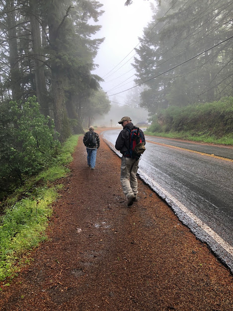
It was a very overcast and wet day, so maybe we were just lucky, or maybe everyone was sleeping in.  We'll never know.  We walked across the street to the trailhead and started the brief brisk walk to the top.  It wasn't very steep, and the hill itself is only at 937 foot elevation and the car had already done the bulk of the climb, so this is an extremely easy one to do after you find parking.  San Francisco isn't known for being very car friendly and many people get to this summit by bus.

Even though we couldn't see much, we did find some decent views along the way in a couple of places of the city skyline and the bay.  I would really like to do this summit again when it's clear, because I think it would make for some great views.  I avoid the city like the plague but I think it would be totally fun seeing it clearly from 900 ft.


Just as you reach the top of the summit there is a small staircase leading to the top.  I found that the hardest thing to climb since my legs turn into jelly when they are on stairways. But it wasn't terrible.


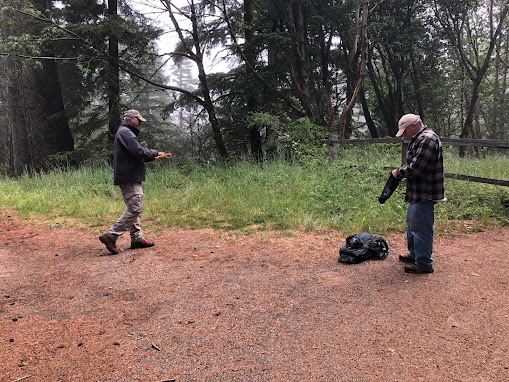
At the summit itself, there's a large open space and a bench to look at at the views, where nobody was sitting.  So we decided to claim it.  After a bunch of attempts by Scott and Peter to try to throw a rope using a small weight up over the branch of a Eucalyptus tree that was a bit high for them to hit, we decided to put the antenna a little lower down on another tree.  But it was still amusing to watch them try.


We were hoping to run into K6EL who apparently lives in the area and chases other summits from this summit very regularly, but there were no other hams at the top.

After we got the antenna situated Peter started with my KX2 on 30 meters as he usually does.  He got quite the pile up and it just kept coming!  I think he had made about 18 contacts before they calmed down and he could give me a chance!

This is Peter on the ground because the bench was wet.  When I operated, I pulled out my inflatable seat cushion and had a comfortable activation with a dry butt when I was done.  Sorry Peter, didn't think about that sooner.


I have been taking CW classes with CW Ops and this was my first time out on summits since I started the basic class.  I had decided beforehand that I was going to really try to make this a 100% CW activation. My speed during the class has gone from about 8wpm up to nearly 18wpm, so I was far more confident than the last time I activated CW.  I tuned up on 40m, spotted, and called CQ, and got about 5 contacts with a little effort required.  I guess Peter used up all the regular chasers on 30m.  I'll have to remember to try to start first next time.

I made a few sending mistakes, and Peter did have to help me with a couple of calls that were down in the noise, but I did okay at 18wpm.  It felt like I was pushing myself a bit, which was good.  My confidence level was really up and I felt comfortable taking control of the QSO's without needing much help from Peter.

While Peter was tuning up 20m and making a few more contacts, I went over to help Scott with the process for activating the summit on 2m FM.  He had set up an Ed Fong roll up on a sign post and was able to reach back into our main San Jose repeater.  After a short explanation of what to say and how to log, I spotted him with the SOTA Goat app and he was able to call out on 146.52 and make enough simplex contacts to activate the summit.

We noticed Austin, K6ABM from Oakland chasing all three of us on all the bands we were working, and on all three summits too.  Really close in line of site with a good CW signal.  Scott also had some fun talking to Cooper, the young son of K6ALI from San Leandro (she was a good control operator).

We packed up the gear and hiked back down to the car.  It wasn't a very exciting summit but the noise level was low and it was really easy to get to.  Sort of like a stroll.

SOTA Activation Info:

There was some neighborhood parking but I'd bet it would be unavailable on a sunny day
Good ATT cell service, good APRS at the summit itself
Hike up is very easy.  Hardest part is there are a ton of deer trails.
No parking fee, did not see any permit only residential parking areas anywhere
We didn't venture from the summit but there is supposed to be bathrooms up there
Several good trees to hang antennas, large summit open area
Very low noise level.  Great summit for VHF or HF activation.
The open bay seems to make up for the lack of height

W5RJD's Log:

Time

Callsign

Band

Mode

Notes

16:27

K6ABM

7MHz

CW

599

16:28

K6KMH

7MHz

CW

599

16:28

K6TUY

7MHz

CW

579

16:30

N0DNE

7MHz

CW

579

16:36

K6LDQ

7MHz

CW

559


WB6POT's Log:

Time

Callsign

Band

Mode

Notes

16:08

K6ABM

10MHz

CW

559/599

16:09

VE7HI

10MHz

CW

449/339

16:10

NW7E

10MHz

CW

579/589

16:11

K7III

10MHz

CW

559/339

16:11

WW7D

10MHz

CW

549/539

16:12

WB7VTY

10MHz

CW

559/559

16:13

NG6R

10MHz

CW

559/559

16:14

N0DNF

10MHz

CW

449/579

16:15

NN7M

10MHz

CW

559/229

16:16

N6PKT

10MHz

CW

449/339

16:17

K6QCB

10MHz

CW

559/569

16:18

N6TVN

10MHz

CW

449/459

16:19

KX0R

10MHz

CW

449/559

16:20

K7SO

10MHz

CW

339/539

16:22

KN6IPE

10MHz

CW

559/449

16:23

K6TUY

10MHz

CW

579/569

16:40

K6HPQ

14MHz

CW

579/529

16:41

K6KM

14MHz

CW

599/599

16:42

N6TVN

14MHz

CW

559/559


KN6KHV's Log:

Time

Callsign

Band

Mode

Notes

16:41

KK6SVH

144MHz

FM

16:44

N6VOA

144MHz

FM

16:47

K6ABM

144MHz

FM

Austin, great guy!

16:55

W6ALI

144MHz

FM

Cooper!


W6/CC-072 (San Bruno Mountain)


We then headed off to San Bruno Mountain, a city or two south of Mount Davidson.  The GPS got us right up to the entrance gate of San Bruno Mountain State Park.  There was a ranger at the gate collecting the $6 entrance fee, who courteously guided us to the "upper" parking lot.

This "upper" parking lot was not the one we thought.  Google maps showed a drive up, with a parking lot that had about 13 spaces right at the summit peak.  When we found out the "upper" parking lot was really just a few hundred feet down the road at the start of the trail head, we realized we were going to have to hoof it.

Gaia GPS was showing a little over 500 feet of elevation gain and less than a mile from the trail head to the summit, so how hard could this be?  We threw on the packs, took a photo of the map board so we had a trail map (I guess our $6 entry fee didn't buy one), and started out.

The trails were narrow - one person wide - and there was what looked like poison oak everywhere.  Sometimes you can't easily tell the difference between wild berries and poison oak, but we treated everything with a danger sign because you never are sure.  A couple of us are highly allergic, and some of these vines extended into the trail.


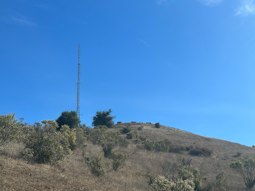
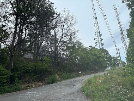
At the top was more large communication towers and buildings than I think we've ever seen on a single summit.  
 

The activation area is very large - and the towers spread out through most of it.


There's a lot of posts and fences near all the buildings to bungee a mast, but we couldn't readily find any easily accessible vegetation that would make a suitable antenna anchor, nor any good place to anchor a mast without needing a lot of guys.  Scott suggested scrambling up a steep hillside and tying the antenna to a post at the top, but we saw more "poison oak" and decided that was a bad idea.

An even worse idea was attaching the carbon fiber mast to a metal stairwell support in front of a communications building.  It was impossible to avoid the security cameras, so we were just kinda hoping we'd be done and out of there before the security patrol arrived.  After all, the no trespassing sign was on the entry door, and not the stairs.  After we got set up, we found the noise level was about an S6.  At that point we were not really motivated to move anywhere so we just decided to try to see what would happen.


It was a struggle.  Peter barely got his activation on CW, and I had to rely on a friend with a super good antenna from San Jose for a 2m FM activation as my fourth contact.  The noise level was killing us on HF, and we could only hear super strong signals, of which there were very few.  I heard F4WBN way down in the mud but just couldn't pick out a signal report. Scott didn't seem to have many issues with VHF even without a pass filter, and got more contacts on this one than we did.  He even bagged a summit to summit back to Mount Davidson where we had just left!

If there was ever a summit to NOT do on a foggy, cold and windy day, this would be the one.  But with the HF noise level at the summit, I think we'll avoid it even on sunny days.  As we were leaving, Peter said, "I'd be okay if we never came back to this one".  We took the paved road back.  You know, the one we originally thought we'd be driving on to get to the top.  The wind on the way was really intense and cold and by the time we got back to the truck, I really wished I had brought my JetBoil for some hot chocolate.  And to think I almost left my jacket in the car.

SOTA Activation Info:

Parking seems easy, it was moderately crowded.
Decent ATT cell service, good APRS at the summit itself
Hike is about a mile, 600ft vertical, not awful.
$6 parking fee paid at kiosk to ranger
Bathrooms at trailhead (we didn't notice any at the top)
Gravel and paved road at top, no trees, setup spots are minimal
High noise level on HF, but VHF appears to be usable

W5RJD's Log:

Time

Callsign

Band

Mode

Notes

18:57

WW7D

14MHz

CW

539

18:59

W0MNA

14MHz

CW

449

19:03

K6ABM

14MHz

CW

599

19:11

KQ6OT

144MHz

FM

59


WB6POT's Log:

Time

Callsign

Band

Mode

Notes

18:40

W6TED

7MHz

CW

559/429

18:42

WW7E

7MHz

CW

449/569

18:44

KI6SYD

7MHz

CW

579/339

18:52

WB7ULD

7MHz

CW

559/519


KN6KHV's Log:

Time

Callsign

Band

Mode

Notes

18:40

K6ABM

144MHz

FM

18:41

KQ6OT

144MHz

FM

Thanks Tom!

18:43

W1EJ

144MHz

FM

18:44

W6ALI

144MHz

FM

18:45

KK6JJZ

144MHz

FM

Summit to Summit San Bruno to Mt Davidson W6nc243

18:48

KN6IKE

144MHz

FM

18:50

K6VVP

144MHz

FM


W6/NC-209 (Sierra Morena)

We started heading down 280 to 92 and thought it would be easy to find some place to eat along the way.  We were so wrong.  After driving in circles for about a half hour, with everything on the GPS saying it was five miles behind us, we finally landed on a Mexican restaurant in Burlingame and sat and had a nice lunch and chat.  Then we headed back up 92 to Skyline (35) and on to Sierra Morena.

This summit is basically a drive up with a really short hike with about 200 ft of elevation gain.  You park at a marked parking lot on the east side of 35, cross the street, walk up on the side of the road for about 1/8 mile, and find the trailhead.  Just be careful because cars love to speed on this road.


Enter the marked trailhead and take a left on the fire road (not the trail).  This takes you right to the summit about 200 yards up.  There is an old communications tower at the top and plenty of shade.  The activation zone is sufficiently large where you have a lot of choices on where to set up, even on the trail itself on the way up.  We threw up the end fed into a tree near the building near a large open space at the entrance of another trail head.


There was a retaining wall in front of the building that might have made a good bench to sit on, but the trees were raining.  In the Bay Area micro climate, what this means is that the redwoods were retaining enough water where they were releasing it like rain drops.  It was dry and warmer when you weren't under trees, so we decided it would be more comfortable to sit on the ground where there were no trees above, and the ground was much drier.  Peter is small enough to be able to sit in those lightweight portable chairs, but I had to rely on my blow up pad instead.


Peter went first again on 30m.  Rats.  He made six contacts, then I got on 40m and activated before I ran out of chasers.  I had to call CQ a lot before I got my four.   Peter was able to bag a few more on 20m.  Then I tuned and spotted on 17m and was able to copy ZL1BYZ - it took me a few tries to get his call because my CW ears were tuned into W/N/A calls and the Z at the start threw me off big time.  Cool, New Zealand on 10 watts!  Highlight of the day!

Scott bagged five on 2m FM including K6ABM who had been following us around all day. This was an easy summit I'd do again if I had an hour or two of spare time.  We took off and got home a couple of hours later than we wanted, but it was a really fun day in spite of the dampness.  

SOTA Activation Info:

Free parking seems easy to get, it was moderately crowded
Decent ATT cell service, good APRS at the summit itself
Hike is only a few hundred yards with minimal elevation gain
No facilities
Large shaded and open area at top for warm or cold days
Activation zone is pretty wide including along the trail up
The comm tower had no appreciable affect on noise levels

W5RJD's Log:

Time

Callsign

Band

Mode

Notes

22:53

K6ABM

7MHz

CW

599

22:54

ND6P

7MHz

CW

599

22:56

WW7D

7MHz

CW

359

22:59

K6TUY

7MHz

CW

579

23:06

N4HNH

18MHz

CW

529

23:19

ZL1BYZ

18MHz

CW

449


WB6POT's Log:

Time

Callsign

Band

Mode

Notes

22:40

N6KZ

10MHz

CW

579/559

22:42

K6QCB

10MHz

CW

559/559

22:45

WG0AT

10MHz

CW

449/339

22:47

W7GA

10MHz

CW

579/559

22:48

K6GTE

10MHz

CW

579/579

22:49

K6ABM

10MHz

CW

579/599

23:05

WW7D

14MHz

CW

559/529

23:07

W0MNA

14MHz

CW

579/579

23:08

K6ABM

14MHz

CW

579/599

23:10

W0ERI

14MHz

CW

579/579

23:11

N6IZ

14MHz

CW

459/559


KN6KHV's Log:

Time

Callsign

Band

Mode

Notes

22:40

KM6SKA

144MHz

FM

22:49

KI6ETL

144MHz

FM

22:50

K6ABM

144MHz

FM

22:52

W6ALI

144MHz

FM

22:53

KQ6OT

144MHz

FM


Comments

Popular posts from this blog

7-19-23 W4C/WM-001 (Clingmans Dome)

11-1-2020, Mount Umunhum W6/CC-052

11-2-23 W6/NC-399 (Coyote Peak)