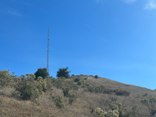
I decided to go for a hike at lunch today, and the trailhead for Coyote Peak is a few blocks from my office, so I grabbed my SOTA kit and took off. I've done this peak already a couple of times, the last time being just after I recovered from Covid and I remember it wasn't very fun, with all the respiratory issues I was having at the time. I was hoping today would be easier.
Just after entering the park, there is a kiosk to pay the $6 day use fee. The automation station only takes credit cards and not cash. There's no permit required, but if you don't have the parking ticket on your dashboard you'll get an expensive ticket. I know they weren't charging during the pandemic, but that's over now.
I parked in the main lot. The trailhead here heads up to the Bay Area Ridge Trail. Right at the start is a supply of paper maps. I'd suggest taking one if you've never been on these trails before, and then returning it when you're done with it. They don't stock them often.
You want to start on the Hidden Springs Trail. If you take the trail on the right you won't end up at the summit. It's really a fire road, and used to access all the transmitter gear at the summit by car.
From here the summit is about 3300ft as the crow flies, and 561 feet of elevation gain coming (according to SOTA Goat). The trail is pretty much an uphill battle all the way, just over one mile of walking. If you have to stop and catch your breath a lot, it will take an hour to reach the top. Those of you in good shape will scurry up in 20 minutes.
If SJC is landing from the south, you'll be just under the landing approach pattern and should see many planes coming in right over your head. If they are taking off south, you won't see much because they circle around the airport to gain altitude before heading south again, and by that time they will be above the clouds.
There's a couple of forks in the trail. I believe there is more than one way to the peak. Check your map before you take a fork. I chose to stay on the main fire road.
About halfway up there's a gate on the road. It's there to keep cattle in, not hikers out. The door is on the left. There's a sign that asks you to close it behind you.
Don't forget to look back as you go up. The views of the valley are pretty awesome, and you can see just about every peak in the bay area.
About 500 ft from the topo, I ran across a nice rock in a shaded area. This is the last shade you'll see until you get back down. Stop and put on sunscreen if you haven't already. Even in the heat, the rock is cool and it's a nice resting place. It's just short of the activation zone though, so that's too bad.
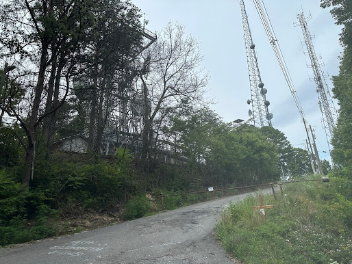
At the top there is a bunch of radio equipment. Instead of heading over there, follow SOTA Goat to the peak. The road loops around the peak and there's a bunch of benches where people sit and take in the view. Near some of the benches are convenient posts to strap a push up mast to. There are no trees, so bring a self-supporting antenna structure.
I went right to 20m and picked up 5 contacts. Peter WB6POT saw my spots and texted me and I went on 2m FM and he heard me well from his house in Cupertino. I then spend some time on 10, 40, 15, and 30 and only got one more contact on 30m. Afternoon, the bands were closed except 20 I guess.
Here's the radio equipment at the top.
Here's a view of W6/CC-052.
And W6/CC-046
And here's IBM Hill with Black Mountain (W6/NC-049) in the background.
I even got up close with a turkey vulture on the way down.


Comments
Post a Comment