7/30/25 W6/SC-357 (Cerro San Luis Obispo)
I was on a business trip to San Luis Obispo and feeling like taking a morning hike, so I picked Cerro San Luis Obispo. I'm trying to get myself back in shape and I figured this one was going to be challenging, but not too much so.
After studying the routes I decided to park at the Marsh/101 trail head and take the route from the east. It was mostly the "M" trail.
As you can see, the "M" trail is quite clearly marked with a giant "M" on the side of the hill that I'm sure you can see for miles.
Gaia GPS has a new feature that gives you trail elevation and difficulty, so I knew I'd have a little bit of trouble on the far east side once I got up to about 800 feet and made the westward turn. The trail was fairly uneventful until I missed that turn because I didn't even see the trail. If you take this route and get to this bridge, you've already passed the trail about 100 feet back.
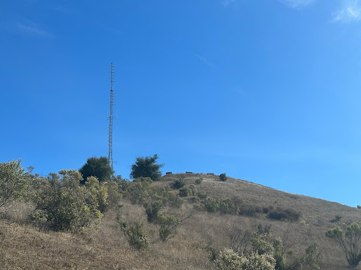
It got a little challenging from there. The trail was narrow and rocky and steep, and poison oak was everywhere. It was also quite foggy so I couldn't see much below on the uphill hike. Here's a photo of the false peak (second summit) to the east of the main summit. I'm sure views from there would have been nice.
After going down a trail of gulleys I finally got back on what looked like more of a main trail, and worked my way around to the east side of the summit and back up the fire road.
The summit had a couple of interesting features. There was what looked like a cage with locks, and a stage. Some hikers were joking that it looked like a human trafficking operation where they lock people up in the cage and auction them off on the stage. I guess it wasn't that funny though. I found out later that they have a giant Christmas tree up on top of the summit and lock the generator for it up in the cage. They use the stage for an event they have on the summit.
Scurrying up a few rocks and I topped the summit. I attached my Bandspringer Midi to my push up, which I attached to the Christmas tree stand. It was out of the way for the most part, and it needed to be, because this was a busy summit with hikers everywhere. I made about 10 contacts including France and Japan. I was using my new BaMaKeY TP-III which I'm finding to be nicer than hooking up the paddles to the KX2. I can be a little free of the radio and it's easier to use the phone and notepad. This is a cool key that's magnetic, so I attached it to a small metal clipboard (this wasn't my idea, it was WB6POT's). It was perfect for logging with my iphone yet keeping a pad nearby if I needed it. The radio was on the ground on top of the Elecraft case and I used a rock for a seat. Very comfortable.
On the way back down, the fog cleared and got a couple of nice photos of San Luis Obispo, and Bishop Peak.
Cell service was great, I even had a business call come in while I was on top and we talked for 10 minutes. Enough data for spotting.
I took the fire road down instead of that nasty poison-oak trail on the east side. There was a couple of forks that weren't super clear so I'd suggest a GPS map on your phone for the way down if you do it this way. If I had to do it again, I would have taken the fire road up too. It's farther, but a much better trail.
Fun activation.


Comments
Post a Comment