We planned to drive through Choctaw territory out of Arkansas and into Oklahoma so we could wind up in Durant and see the newly opened Choctaw History museum. I found three drive up summits along the same stretch of road that wasn't too far from our route, so I made plans to do them all in the same day.
They have all been activated a lot and there were some recent summit access notes so I felt fairly confident we could pull this off. It was a long day, but we made it.
W5A/OH-001 Rich Mountain
The first one we'd tackle was Rich Mountain. If you put Rich Mountain in Google Maps, it doesn't take you to the summit, but it does take you to the town of Rich Mountain which is the best way to get there. We stopped at a really old general store, almost a shack, where we think we met the entire town. There were four men playing checkers in the back and a fifth bringing in something from the car. Very friendly bunch. Our main purpose was a bathroom stop before heading up to the summit. We don't like stopping to use restrooms unless we buy something from the business, but they hadn't been stocking much in the store except a few candy bars and sodas that they were picking up from Walmart in the city once a week. I picked up a couple of things and we went on our way.
From this general store in Rich Mountain, head up 292 and back down 88 a couple of miles. You are actually looking for the Rich Mountain Fire Tower, a US Department of Agriculture picnic area.
The picnic area has a paved road heading up the hill to the summit, but it was gated and it was obvious it was closed to auto traffic. But there were no "no trespassing" signs and it wasn't clear it was closed to foot traffic. Down the road a spell we saw the Rich Mountain trail crossing the road so we figured it was hikeable anyway. So I slipped under the gate and left Michele parked at the bottom to make some phone calls for work with the one bar of ATT signal she had.
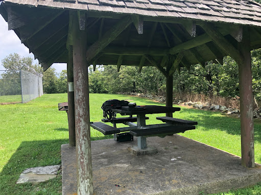
The walk was about 1,000 feet up the road. There was some remains of what was obviously a fairly nice picnic area, with covered tables and pit toilets, a good size grass meadow, the abandoned fire tower, and a few comm towers.
There were plenty of trees to hoist up my end fed, so I picked a table with the most shade to operate from and started string up in the antenna.
Everything there was not being maintained any more and it seemed like it was at least a couple of years since the maintenance crew came through. The table was metal and in good shape, but it was wet so I got out my inflatable seat to keep my butt dry.
I just purchased a Zoleo satellite SMS device, and there was virtually no ATT data service at the top even though the phone showed 2 bars of signal. So this was the perfect use case for the Zoleo. I used it to text Peter (WB6POT) to let him know what frequency on 20m I was tuning up on so he'd be ready. Then I sent my first SMS spot with the Zoleo. The pileup didn't take too long to show up.
Peter was already on frequency so he was my first contact, followed by several others including summits to summitss from KX0R (W0C/SR-031) and trusty K6EL once again on Mt. Davidson as he seems to be almost daily (W6/NC-423).
I also worked WU7H again - but I didn't hear a summit designation so maybe he was in his shack at home. I'll check his logs again later and see if he was on a mountain top.
This had taken about an hour already so I decided to not try any more bands and get back to Michele in the car so we could move on to the next one.
W5O/OU-006, 2290
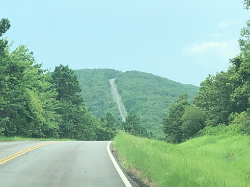
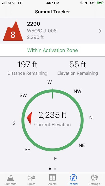
About 30 miles away on the same mountain road (Highway 1) is peak 2290. You have to go down in elevation a spell and then climb back up to the peak. The road goes right through the top, and the activation zone includes the road itself. You can bushwack a few hundred feet to get to the summit proper, but I decided to pull over to the right in the grass and operate right on the roadside.
I grabbed the folding chair and launched my 550 paracord into a tree and hauled up the end fed. It took me several tries to hit a branch at the right height but i finally got it. The grass was green, wet, and about a foot tall. It was hot and humid and there were mosquitos around, although they weren't annoying enough for me to the get the bug spray out.
It was extremely fortunate Michele took this photo, which I'll explain on the next summit.
I texted Peter on my Zoleo and asked if he could hear me at all on 40 meters. He didn't come back right away, so I spotted and called out on 7.060. I got one contact, called CQ a few more times, and then assumed nobody was around on 40m. I moved over to 17 meters and Peter was there with a strong signal, and after a bit of work I got a couple more for 4 total. This summit took about a half hour of work for 4 contacts. It was starting to get late, so I really quickly packed up. Normally I am very methodical and put stuff back into their bags but I just threw it all in the pack so we could get to the next summit as quickly as possible. As I was about the close the bag there was a rather large cricket-looking bug inside the pack so it took me a little while to coax it out so I could close it.
There was a tiny bit of cell phone data service so I was able to spot out with data this time instead of using the Zoleo SMS gateway, but it was not 100% reliable and it took some retries on each spot.
Then we sped off to Sycamore Lookout, which was only about 10 miles or so up the road.
W5O/OU-005 Sycamore Lookout
The last summit was a about 10 miles or so up the road. I was wondering what the drive would be like, since the SOTA rules say there needs to be an elevation drop between summits and there was such little distance I was expecting a dramatic down climb before climbing back up again. But it wasn't that bad.
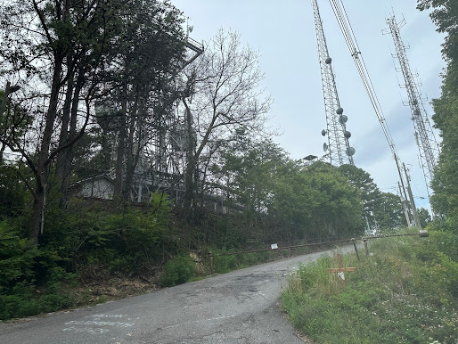
As you approach the summit you can see the communication towers sticking up above the tree line. You have to start watching, because there is a small gravel road on the right that leads up to the site. You can literally drive up 75 feet or so and park right under the towers.
At first I choose a semi-shaded area up from the road a bit, where I thought I might be able to attach my push up mast to a cyclone fence and elevate the end fed with the mast. There were some trees, but after the experience at 2290 I didn't want to mess with trying to hit the right branch. So I bungee corded the mast to a fencepost, ran my 7 feet of RG-174 to my chair in the shade, and got the radio out. When I reached for the CW key plastic bag it was empty. Oh yeah, at the last summit I just threw everything in the pack, so I started taking everything out piece by piece until the bag was empty. No key! Yikes!
I texted Peter and hooked up the mic and we tried SSB on both 20m and 17m with very weak results. I had enough cell signal to have a phone conversation with him. I tried a couple of CQ's with no takers, and then I decided to pack everything up and make the drive drive back to 2290 to see if I could find the key. After I explained the situation to Michele, and let her know the cost of that key, she was very supportive in driving back, although justifiably annoyed. She wanted me to get the last activation whatever it took. What a wife!
When we got there, it was just one huge green blob of foliage. We tried to find the tire tracks from the van in the grass, and we were able to get an approximate spot, but all the trees looked the same. I figured there was no way I was going to ever find the key. After looking about 5 minutes, I remembered she had taken a few photos of me operating, so I got the phone out and was able to pinpoint exactly where I was sitting based on the tree trunk patterns. And there it was sitting on top off the grass! I grabbed the key and we started heading back to Sycamore.
Michele suggested I set up in a different area farther away from the comm towers, and I decided to try the portable vertical instead of the end fed. So I set it up and stretched the radials, working about 10 feet from the car. One of the longest hikes for any summit I've ever been on.
ATT data service was minimal but I was still able to spot out on the Internet.
Once again, it took a little work to get contacts, but I was able to exchange a report with VE2JCW, Peter, and 3 others to activate. Lots of CQ on this one though. It was already 5:30PM local time, so all that was really left was the left coast.
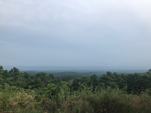
This summit almost had a view. On the previous two I could not see anything but trees. We left the summit and pulled into a turnout to admire the valley. I was still pretty because it was so green, but I have to say the 2400 ft Oklahoma 8 point summits are not quite as impressive as the 3000+ foot 1 and 2 point summits back in California.
We left the skyline ridge road we were on and went back to the Valley so we could get to our hotel in Durant.








Comments
Post a Comment