11-6-21, Marys Peak W7O/CC-001
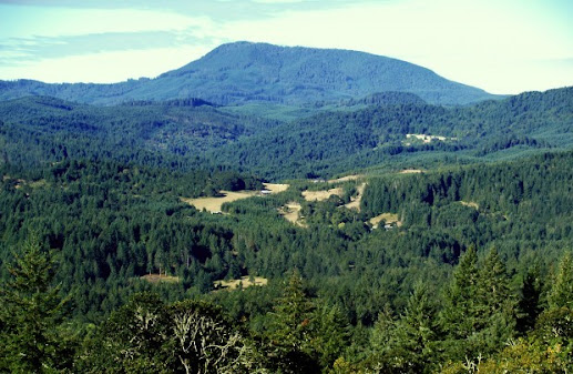
I was on a business trip to Oregon and decided to stay the weekend. There was a summit about an hour away from the hotel. It was the highest point in Oregon at a little over 4,000 feet, although small by California standards. This was a cold and windy day, and it was lightly snowing, so I didn't really take any photos. I took the above photo off Google images, because you could not see the mountain through the clouds at all.
This is a drive up except the last mile, which is an easy hike with about 350 feet of elevation gain to the summit proper. I got to the parking lot about 7AM, but it was too dark and windy to start the hike. I feel asleep in the car until about 8:30, then waited another half hour or so for the wind to die down a little. I got out of the car to check out the use fee, which was $5, and all the payment envelopes were wet so the slot to put them in was blocked. After I spent a couple of minutes trying to stuff the payment into the post, I gave up and started the hike.
A few hundred yards up the trail, there was a thick line of evergreens that were breaking the wind, and that part of the hike was actually pretty pleasant. As I approached the top, I noticed the trees were starting to go away and it was becoming more windy and cold. I spied the last tree on the trail, and really hoped I'd be in the activation zone so I could use it to hold my end fed, but it didn't quite make it.
Another hundred or so feet up the trail was a picnic table in the activation zone, with a tree fairly close to it. But wind was crazy, the table was icy, and it was cold as heck. I launched the end fed into the tree, and didn't bother to stake it down because it was just so freaking cold. I hooked the antenna to the radio, and as I was reaching for my notepad, the wind blew the radio off the table. After chasing it down and feeling frostbitten in my face, I decided this was going to be a really quick one.
AT&T cell service was really weak, but I managed to get a spot out on 40 meters, and Peter WB6POT was right there as he knew when I was going to be starting. K6EL from Mount Davidson came back, and then I called CQ for a good 5 minutes with no response. I switched over to 20 meters and painfully spotted again, and only got one taker after multiple CQ's. I moved over to 30 meters, and while trying to spot I noticed my cell battery was down to 6% (it was at 100% when I left the car). Peter texted and said he was sending someone over to 40 meters, so I went back and quickly grabbed W6DT for my fourth.
My iphone gave me an error message that it was shutting down due to temperature, and I had no battery left anyway. My sole concern was getting back to the car and turning the heater on, so I shoved my end fed and radio into the pack, quickly checked around to make sure I didn't leave anything behind (it probably would have blown away already anyway), and nearly ran to the part of the trail with the trees to break the wind. By this time, it was starting to snow again, so I briskly walked to the car, threw the pack in the back seat, and turned the heater on. It took me 20 minutes before I felt like my fingers would work again!
As I drove down, I took a single photo of a waterfall about 2 miles down the road.
I can see this summit being closed off when there is snow at the top, as there are two gate locations that are obviously closed up when they need to be. There wasn't really any snow on the ground, and the road itself was very good all the way to the parking lot.
When I got back to the hotel, I really regretted stuffing my antenna into the pack. It took me an hour and a half to untangle everything and roll it up properly.


Comments
Post a Comment